Referring to our last post: Our 2023 Cruising Season Departure… And The Hudson’s Bay Rule (HBR to the initiated)”, we followed the HBR to the T. Our Navionics system failed. Per the HBR, we returned to our home port to effect repairs. After consultations with several Port Towsend based marine electricians, Jo and Andy, and deferring to lessons learned from Jim Dixon in San Diego, we rewired the offending contraptions. Tests determined that the rewired new bus bars and fuse block resolved the issues.
Food stores replenished. Water tanks full. Good passage weather window attained.. Light winds out in Juan De Fuca. Minimal cloud cover. Excellent visibility. Currents in our favor. All systems go…
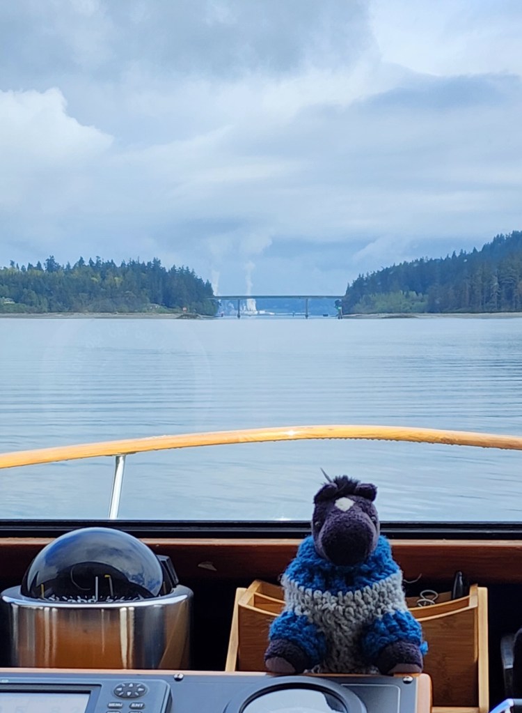
Depart prep accomplished. Navigation systems on line. Communication systems on line. Ginny on at 08:11 providing pure sine wave electrons. Fred and George (Our trustworthy Caterpillar 3208s, fired up at 08:30. Navionics rock solid. Docking camera on line with visuals of Les untying dock lines and climbing aboard. Bow and stern thrusters singing a mechanical duet pushed us handily off the dock. Fred and George turning the props to move us out of the marina and into Port Ludlow Bay, their rumbly sights set on gaining the San Juans for their charges. 08:30 depart logged.
Just past Burner point a few buttons were pushed and the course I prepared to get us to Parks Bay was fed to the autopilot. Leaving Ludlow, I hailed a Nordhaven 45, Slow Burn, ahead of us, to discuss his intentions: The Port Towsend Canal or out around Marrowstone Island routes… He chose the out and around method. I took his stern and made for Oak Bay and the Canal. With the exception of self steering through the Port Townsend Canal, maneuvering around the odd log and patch of kelp, and a massive sailboat race starting by Port Hudson… I never touched the wheel until arriving at Parks. The nav system has been repaired!
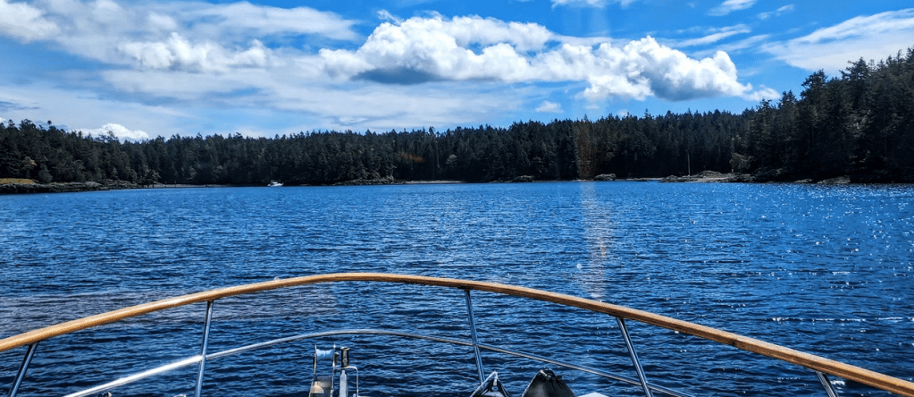
09:20. Passing through Oak Bay, we are approaching The Port Townsend Canal, a handy short cut to Port Townsend.
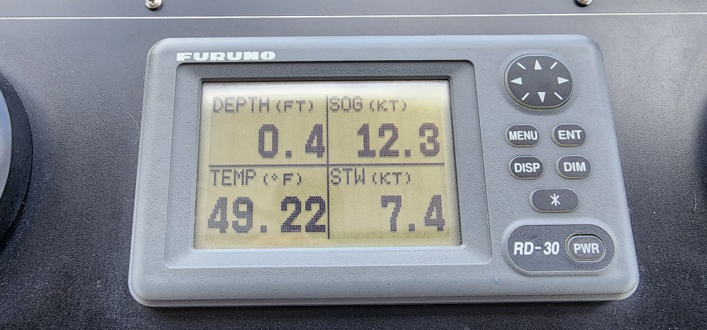
09:30. We glide through the Canal. Always a bit of navigational fun. We always time the transit to maximize the current going in our direction. Our Speed Through the Water (STW) was 7.4 knots. Our Speed Over Ground (SOG) was 12.3 Knots. A 4.9 knot “push”. Free velocity made good (VMG).
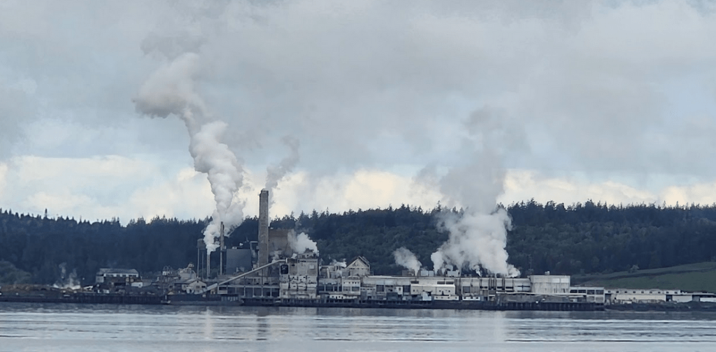
Proceeding through we reach the Northern Exit / Entrance of the Canal and enter Townsend Bay. The view to port: the Port Townsend Paper Corporation Mill. They make kraft pulp, paper, containerboard and specialty paper products. The mill has been there for over 85 years. Not the loveliest shoreline view, but quite useful for us. We look at the steam plume to see how windy it is. It gives us an idea how windy it might be out on the Strait. Not much wind, eh”
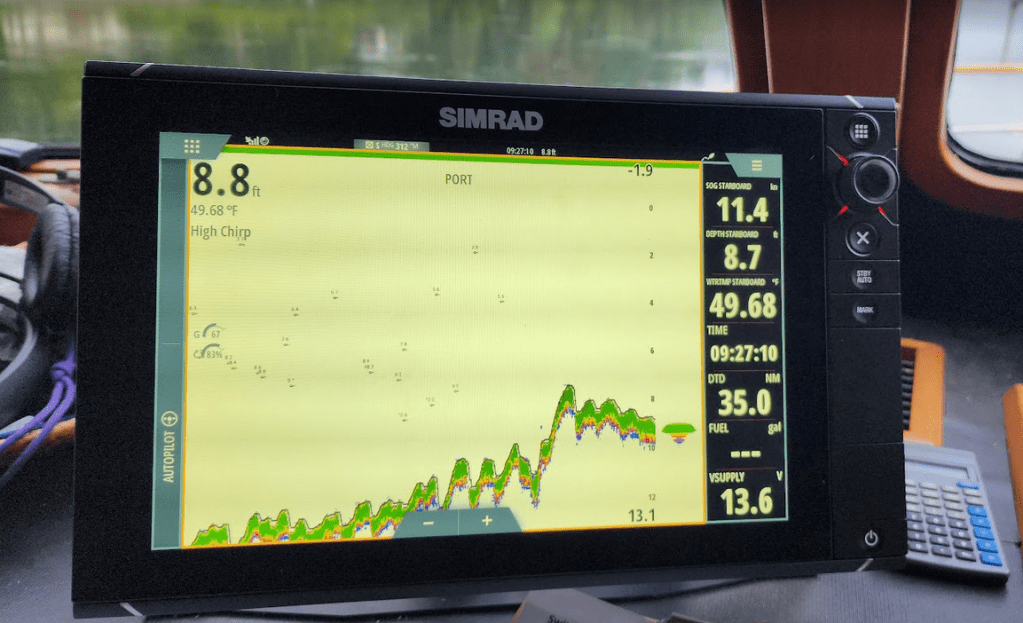
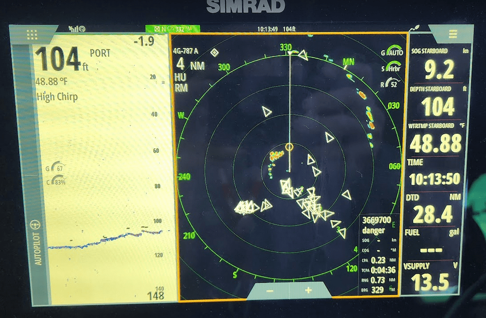
09:45. Leaving Kala Point to our port side, we reach Port Townsend. At Point Hudson we had to self steer through the start line of a huge sailboat race. Once we figured out where the committee boat was anchored and how the start was configured, we make our way through the melee. This is what the radar looked like:
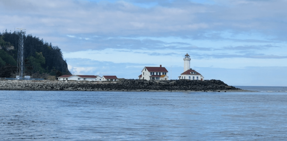
10:15. Just beyond the race course we passed the Point Wilson lighthouse and slid into Admiralty Inlet where we enjoyed another “push”. SOG 12.2 knots / STW 7.4 knots. We were mechanical flotsam being flushed out into the Strait:
Entering the Strait is always interesting. After consulting multiple governmental and private weather services, it is always pleasant to discover that they were accurate predictors of what to expect. Sometimes they are not… and the Strait can be a dangerous place to be with a brisk wind blowing against an outgoing tide. In our case… the weather was perfect, just as predicted and reported.
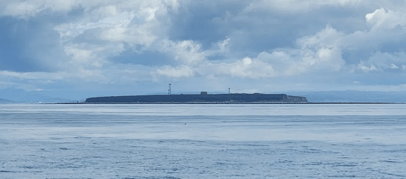
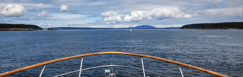
11:30. Next navigational point of interest (POI): Smith Island:
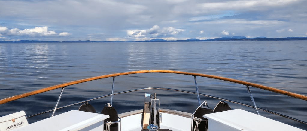
11:37. 15.6 miles to go. Glassyish seas. light wind. Excellent visibility:
12:45. Entering Cattleman’s Pass separating Lopez from San Juan Island. An outgoing current slowed our approach. The only time during the passage when our SOG was lower than our STW:
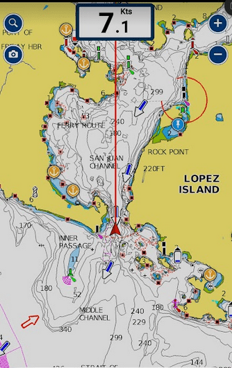
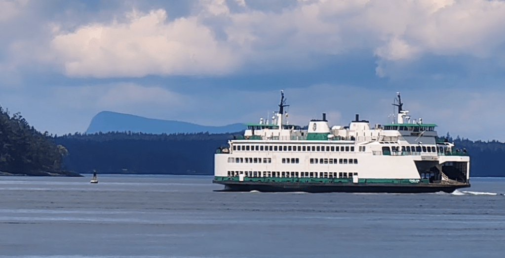
The other way to get there… a Washington State ferry getting close to Friday Harbor, San Juan Island:
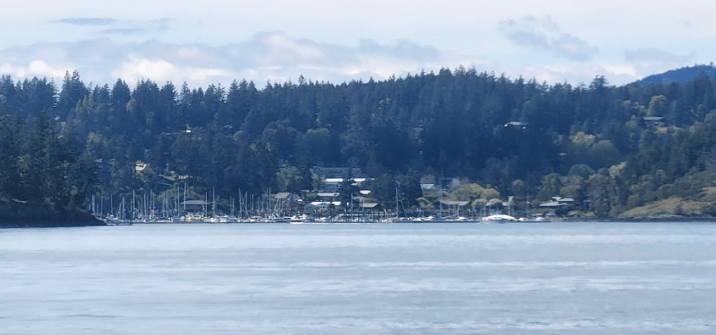
13:17. Friday Harbor in the distance… Nearly to Parks Bay…
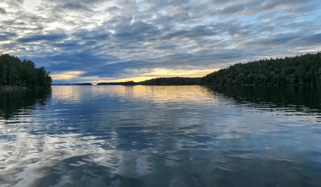
13:30. Entering Parks Bay. 2 boats anchored in this small bay just 1.7 miles from Friday Harbor… but a world apart:
20:00. A Parks Bay sunset. Wine in hand… A successful passage across the Strait:
Next up: Prevost Harbor for long hikes to the Turn Point Lighthouse, then off to Sucia at our favorite spot to anchor and time to lower the kayaks into the water… After that: Friday Harbor for fuel and then… off to Canada.

Good article!
On Wed, May 10, 2023, 7:15 PM Northwest Boating Travels With Blair, Les,
LikeLike
Love the story and pics!
LikeLike
Fun to write about, but more fun to experience. As you know… travel is good for the soul…
… Blair
boatingongreatnorthern.org
On Thu, May 11, 2023, 10:09 Northwest Boating Travels With Blair, Les, and
LikeLike