There are two types of sailors… Well of course, there are many more than two. There are racers, cruisers, armchair aficionados, vagabonds, pirates and their ilk, and those who have migrated to the light side: power boaters. For all intents and purposes, all the variant types boil down to two subsets based on an eventual point of bifurcation: those who have run aground and those who have yet to run aground. I have been an affiliate member of both colleges: grounders and floaters.
Most recently it was the Swinomish Channel that sponsored my third induction to the inveterate that inhabit the fertile and swelling ranks of grounders. The Swinomish is an 11 mile long channel that connects Skagit Bay to the South and Padilla Bay to the North. The town of La Conner is in the middle. It was created by dredging through a series of tidal sloughs, salt marshes and mudflats in 1937 to create jobs and opportunity during the Great Depression. It is heavily used by fishing boats, tugs, recreational craft and “shallow-draft” freight vessels. Emphasis must be placed on shallow draft… The Army Corps of Engineers dredges it routinely to keep it from silting up etc. The channel is completely benign and safe as long as you keep within the “well-marked” channel and pay due respect to the interesting interplay of tides and currents within the channel.
Silting is the issue between dredging operations, and I ran into heavy silt (read soft mud) within the marked channel just north of La Conner. Well… I might have been a bit outside of the marked channel, and there is the possibility that the temporary use of an autopilot contributed to the event. At any rate, my soft grounding, my third on record, was easily remedied by a quick reversal of engines. That is my story and I’m sticking to it.
Enough prolog you say? What does all of that have to do with developing a passage plan from one spot to another? Plenty. The art of navigation must take many things into consideration. What is the weather going to be like? How much wind is expected? Will it be raining? What are the tides and currents to be encountered? What obstacles are between the start of the passage and the end? Where will marine traffic be expected such as ferries, bulk carriers, tugs towing and pushing barges, container ships, recreational traffic etc. Interacting with and avoiding marine traffic, shoals, reefs, rocks, islands and shoreline are all part of active planning and successful passage making. Onward…
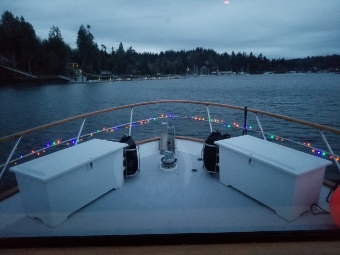
It all starts out simple enough. We were anchored in Gig Harbor for the night so we could pick up our new dinghy the next morning. After receiving the dingy our plan was to test it, then hoist it up onto its fly-bridge lair for the passage. In the summer we have been known to tow the dinghy for short passages in good weather, but do not like to do that during the winter months. As we sipped a postprandial tot of Josh Cabernet, we discussed about how we would make our way up North to our next destination: Anacortes for a winter haul out. With the shorter daylight hours of the late fall and winter in the Pacific Northwest, shorter passages are better than long ones. Twenty to 30 miles can easily be done during daylight hours. Also, passage planning tends to take on a bit more in depth analysis than what we do in the summer months. In the Pacific Northwest there is a saying: “If you don’t like the weather, it’ll change. just wait 15 minutes”. That seems to be even truer in the colder months.
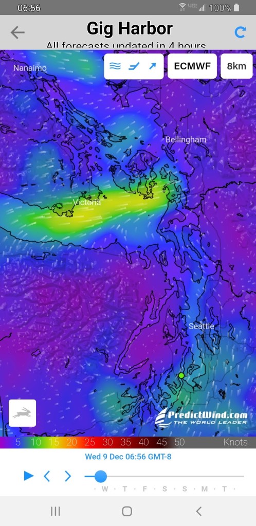
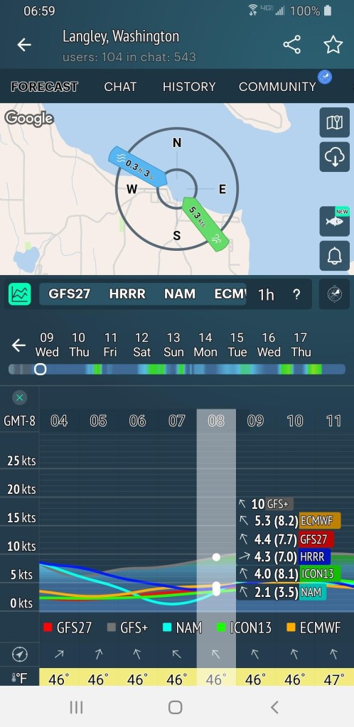
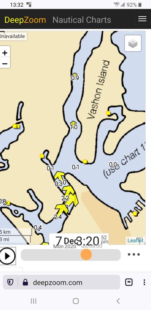
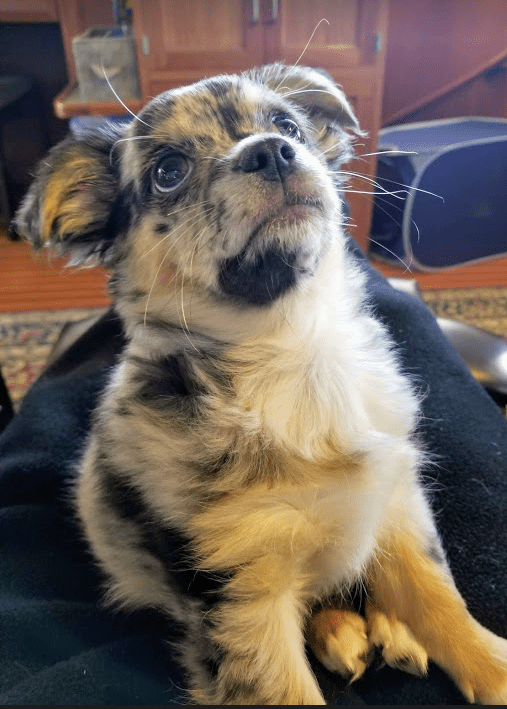
There are many books and charting systems that help to describe the tides and currents that will be likely seen and felt along a passage route. We have some of them, but are more inclined these days to consult several smart phone programs that give very clear presentations of weather, tides and currents based on data reporting times and highly intuitive algorithms. The graphic displays are easy to understand. Two of the best are PredictWind (the first picture that seems to have the best over all graphic. Windy, the second picture gives great and accurate trend lines of wind or waves or any of many other parameters, and graphically compares 5 different modeling systems. The best being ECMWF (European Center for Medium-Range Weather Forecasts). Yes that’s correct. It is far better than NOAA. The 3rd is a picture of a program called DeepZoom. It takes managing the negotiation of currents to the next level. The third picture is of Leo. We asked him about what we’d do if we encountered pirates during the passage… he is after all Great Northern’s official Master-At-Arms.
So, we quibbled, sipped, thought deep thoughts, consulted the data generators, and determined that Gig to Madison to Everett or Langley, to La Conner to Anacortes was the ticket to ride. Nice short passages with plenty of bail out options should the weather deteriorate.
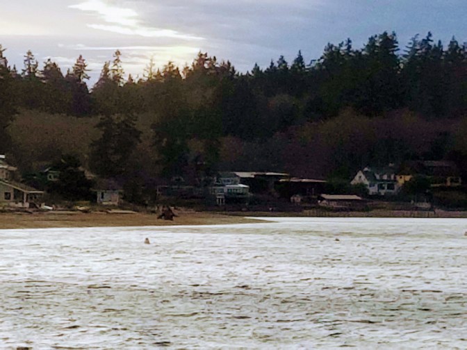
Our first leg was Gig Harbor to Port Madison, an inlet on the north shore of Bainbridge Island. That is what we’ll use to demonstrate the tools we use and how we use them.
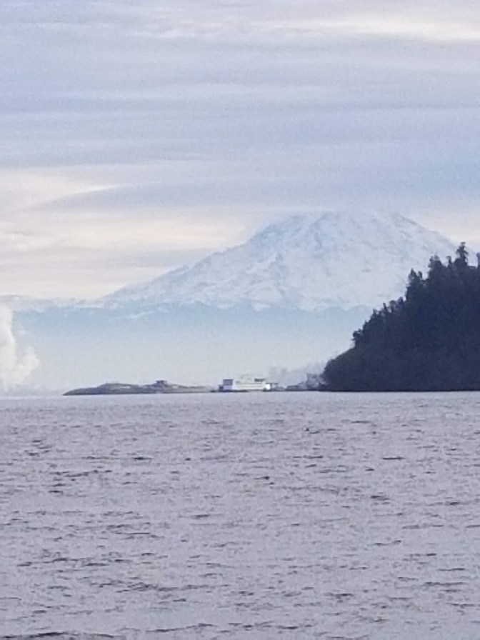
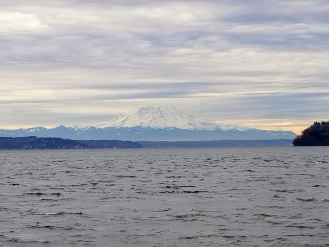
As you leave Gig Harbor you pass then end of Point Defiance and encounter Mount Rainier if the cloud structure allows it. This is a winterish view with a bit of telephoto added in for drama.
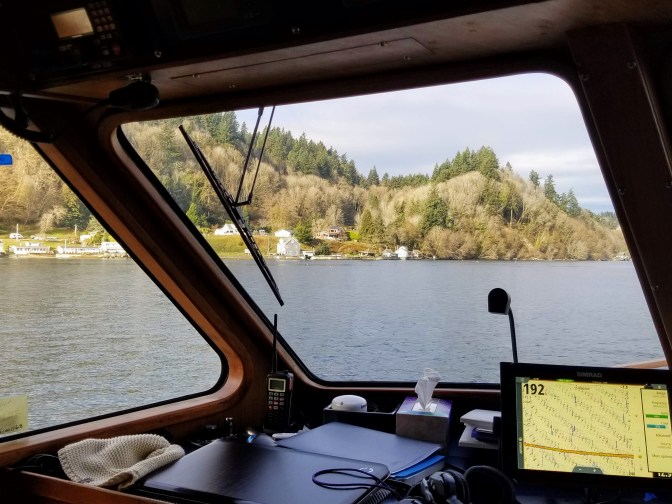
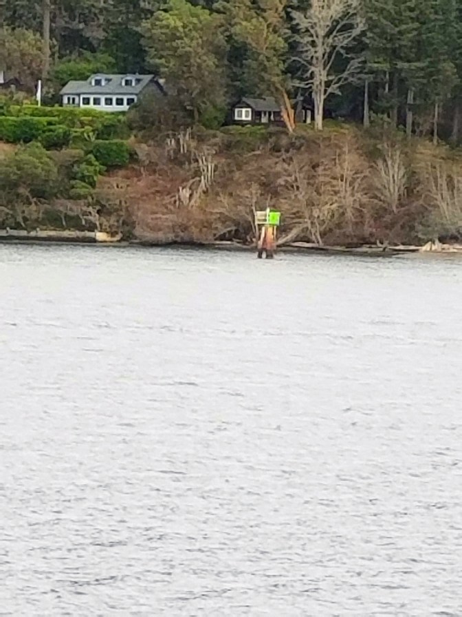
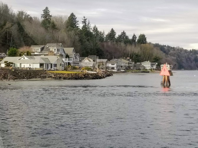
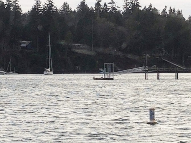
The first part of the leg takes us up Colvos Passage which floods the area between Vashon Island and the “Peninsula”
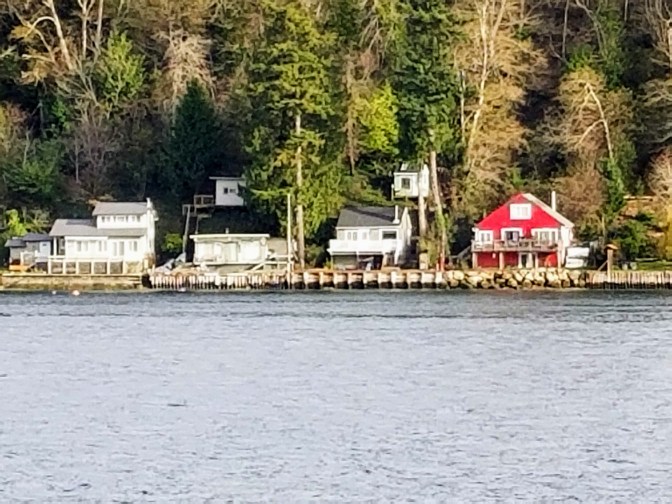
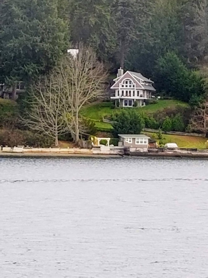
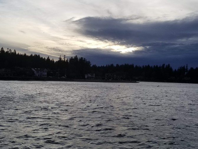
Just some of the sights along Colvos Passage
The tools that we use during a passage:

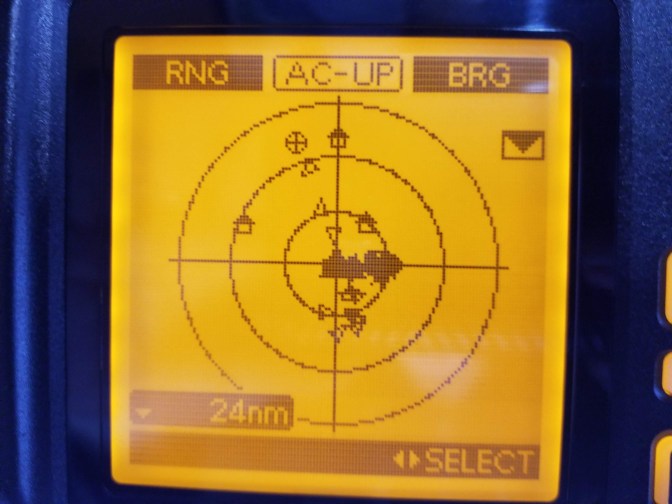
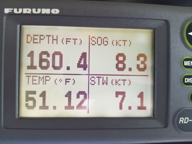
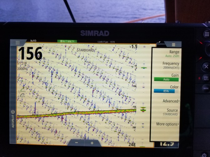
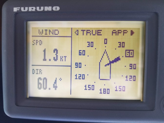
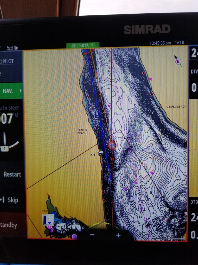
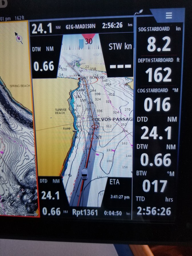
In addition to paper charts and a compass, which are always good backups to have around, we have 2 chart plotters, two radars, 2 depth sounders and multiple instruments that tell us what is going on “out there”, where we are at all times, what the current is doing to us, and importantly, 2 very good stabilizing binoculars so all can be visually verified. We never rely upon one system to tell us all of that information, best to have several, but never one. For charting… we have the two chart plotters, 2 independent smart phones with navigation charting software, 2 tablets with independent navigation software and a laptop with a powerful charting system. If all fails we can use Google maps.
Sound a bit overkill? Well… maybe yes… maybe no. But on a passage from Pleasant Harbor 25 miles down Hood Canal back to Port Ludlow a couple of months ago, our Simrad system swallowed a fur ball. We lost charting, depth, speed. You name it, it was gone. So… we started using the cell phone programs to determine where we were. They do not require cell, just satellite via GPS. We used that until I could boot up our “backup” laptop charting system, then used that. Ship happens. Best to have backups to the backups I say… Computers are fallible. Don’t trust them. It’s one thing to lose a Word document. It’s quite another to lose your charting program and radar in the fog with a 3 knot current going against you and driving your boat onto a reef or into another boat. Nuf said probably…
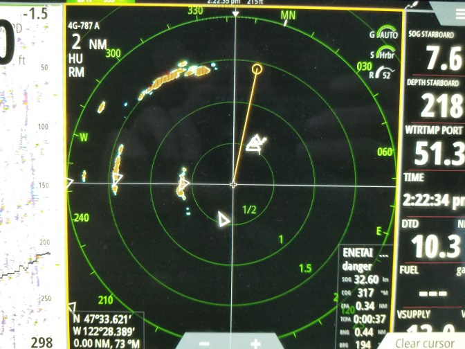
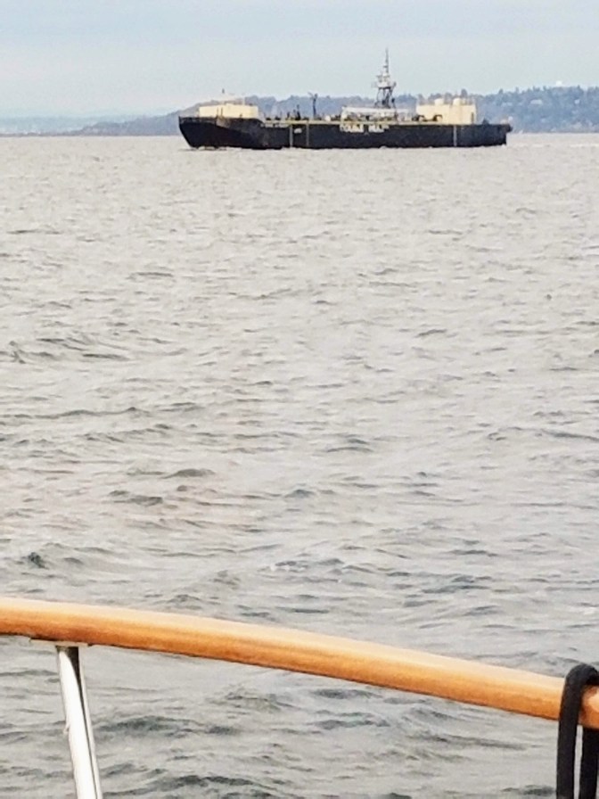
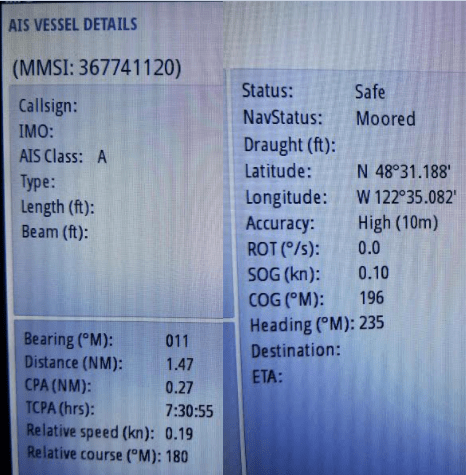
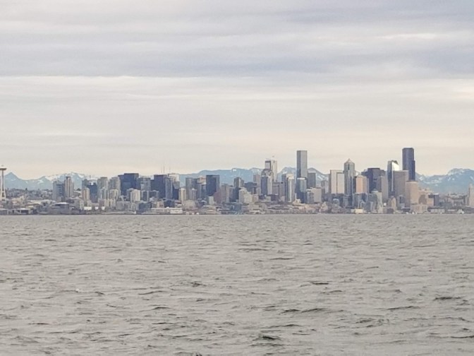
After Colvos we entered into an area with lots of commercial traffic going between Seattle, Southworth, Vashon, and Bremerton . Ferries, bulk container ships, Oil / diesel barges, tugs pulling and pushing tows. They were all out and about doing their commercial boat things. The tools to follow their activities are: AIS, radar, binoculars, and a kewl program WSDOT Vessel Watch that Les discovered.
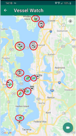
WSDOT Vessel Watch tells where all the Washington state ferries are, at dock, in transit, when they will leave the dock and arrive at their destinations, heading, speed, all in a smart phone graphic program.
Click on any ferry or ferry terminal and you will find out when a ferry will leave that location, arrive, if it is on time etc. The ferry name is there as well so you can call the skipper to let them know that you will be taking their stern etc.
You can also click the video icon in the right hand corner to show you the vehicle line up at the ferry. For the ferry passenger, a very nice to know bit of info. For the boater wondering if the ferry will depart on time and cause a collision trajectory, you can look at the video cam to see if the ferry is still loading which might mean a later departure and the 5 minutes gained will get you past the ferries route of travel so you can focus on the bulk oil carrier that a large tug is pushing into your path from Starboard (right side of the boat) which means it has the right of way and you need to call the tug and let the captain know that you will pass behind it.


I enjoy your blog. Yeah, thank you very much. https://community.idera.com/database-tools/powershell/powertips/b/tips/posts/converting-word-documents-from-doc-to-docx-part-2
LikeLike