Les said a year ago, “12 months from now, we will not be the same people as we are now. We will be different in many ways. Mark my words”. I considered them marked, as did she. Twelve months have passed. On our interactive surface, we are similar to what we were before, but how we are developing under the surface, we are not. Now we have the grace of time, before we did not. Now we are nomads, before we weren’t. Previously we were tied to professional obligations. Now, most of that is in the past. How we collect and add to our life experiences has been altered. If what we seek adds to quality, we migrate towards that. If it doesn’t then it is marginalized. Time is a profound gift, and it is not to be misused …
It does seem like a past life, observed through the mists of an earlier memory, since the Friday evening I locked the Pharmacy, turned in my key and drove home to our rental in Coronado. So much water had already sluiced its way under our keels… We’d sold Herons Flight, our Hampton 49, bought Great Northern a DeFever 53 and spent most of our time between Coronado and Tomahawk Island near Portland, outfitting our new boat. After my retirement, we moved out of our temporary apartment in Coronado, spent a few days at Jack and JoAnn’s place, (brother and sister in law), then packed up our boating related stuff into a 12 foot van and drove that and our Prius up to the new boat. Driving at freeway speeds in an aging van, with loose suspension, ball joints ready to explode, 40- knot crosswinds with 55 knot gusts and triple trailer sixteen wheelers was worse than a taking a ride with Mr. Magoo.

Enough preamble. This is a narrative about a passage, so I’ll get on with it…
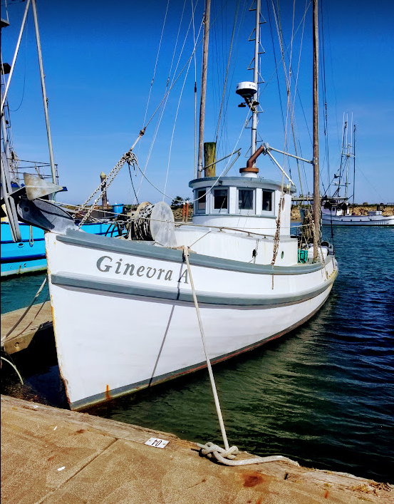
Everyone has a story to tell about the slog to windward along the West coast of Mexico and the U.S. The Baja Bash, the West Coast Climb and the Monster Mash all come to mind. Large swell from the Northwest and winds in the 25-35 knot range are typical. Yes, you can be fortunate to see less, and during a passage up the coast you will, as we did. But you will also have moments when you wonder just what the hell made you want to be offshore in a relatively small boat with darkness fast approaching, banging through 15-20 foot short period seas off of Cape Mendocino. I’m assuming it is similar to attempting to climb the tallest peak. It was there after all to be conquered. But… huddled in your shaking little tent at 19,000 feet perched on a dubious flat spot overlooking a 10,000 foot drop, ice pitons screwed into the ice to hold your habitat in place so 70 knot, 40 degree below zero winds won’t blow you off into the abyss… Similar thoughts just might swirl through your mind.
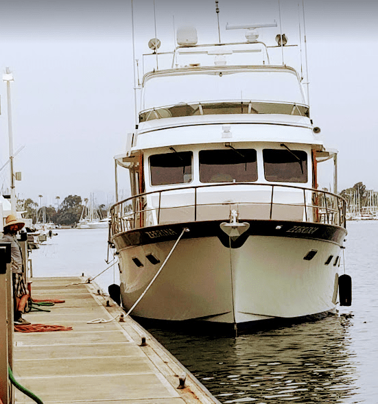
4/28/19. We left Marina Del Rey on April 28th, 2019. Les and I were aboard Zebrina, a DeFever 53 Performance Offshore Cruiser. Bob Feldman, the owner and someone who has become a very good friend of ours, needed crew to help deliver Zebrina up to Des Moines, Washington so Bob and his wife Birdie could spend the summer cruising season in the Northwest, something they do every 3rd year or so. We wanted to do it because he is a very knowledgeable boater and his boat was exactly like ours. We wanted to grapple with the passage on a boat like ours so we’d know what to expect when we finally took Great Northern offshore from the mouth of the Columbia to the Northwest. We wanted the experience, Bob needed a crew and we somehow convinced him to take us along.
Boy howdy… did we get “experience”! It all started out quite nicely, thank you very much. The seas were calm and winds were moderate throughout the Santa Barbara Channel. We rounded Point Conception, the Cape Horn of the Pacific, in 5 knots of wind and 1 foot swell. That’s as smooth as it gets around that Point, and the smoothest Les and I had seen it on earlier passages.
4/29/18. Smooth water and moderate winds continued all the way up towards San Francisco. During her watch between 2100 and 2400, Les piloted the boat alone, in the dark, weaving through several tankers and seagoing tugs offshore of San Francisco Bay. Bob and I were sleeping soundly down below.
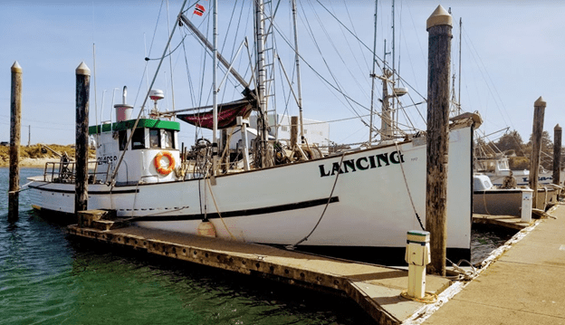
4/30/19. Five hours later, after Bob’s shift and an hour into my 0300-0600 shift, we were 15 miles offshore of Bodega Bay and I ran into a fleet of fishing boats. Well, figuratively really, I didn’t hit one… None of them had AIS on, but all had their huge lights on, some just a mile or so away and others whose lights could be seen, but only faintly just over the curvature of the Earth, which means they were more than 6 miles away. Since radar showed them to be going around in great circles, they were either deploying or retrieving their gear. What kind of gear, I had no idea. After weaving through a few of them, I called Les up to help out so we could sort out what kind of nets were in the water and how we might get around them. We finally had to summon the Captain up to the pilothouse to help us get through. Bob slowed the boat down, studied the radar, peered through the darkness, made a few course changes, smiled, nodded, and went back to bed. Mischief managed. Experience gained. The smiling part helped.
4/30/19. During the next day, the seas began to build along with the wind. We rounded Point Arena in 8-10 foot swell at less than 10 seconds. That’s a bit rough, but as long as we kept our speed between 5 to 7 knots we seemed to be fine.
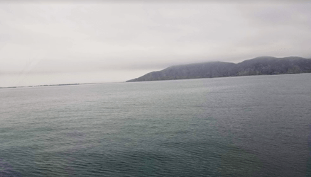
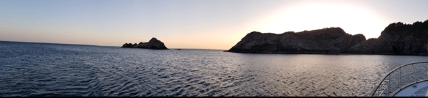
The sea state continued to build. We had a confab and decided to tuck into Shelter Cove which is a bit past Jackass Gulch and Point No Pass. Great names, those. Shelter Cove sits just behind Point Delgado and provides respite from Northwesterly wind and swell. We arrived just before sunset on April 30th.
Delightful anchorage in about 60 feet of water. Shelter Cove lies behind Point Delgada with a reef system that helps to attenuate swell reaching the cove. It was a bit windy, but nothing unusual for this part of the coast.
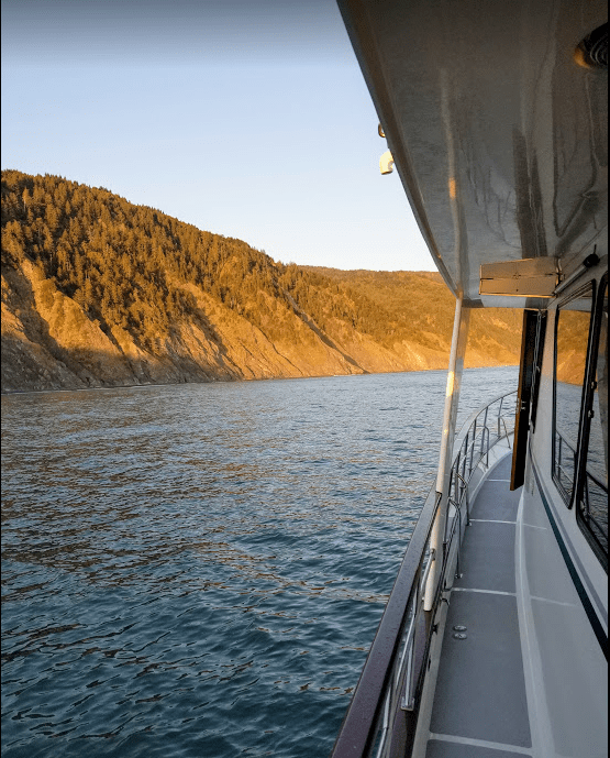
Looking down the coastline behind Point Delgada.
What a restful spot after the constant motion. A dangerous place in Southerly weather, but delightful when the seas and wind are from the usual Northwest.
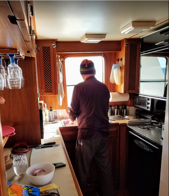
Finally, I could cook a meal without having to hang on to something solid so I wouldn’t fall down. Pollo affumicato con fungi y orichetti. Sublime gastronomic treat, enhanced by the relative calm within the anchorage while the Point and reef constrained the pounding rhythm of the seas. We may have had a tot of wine…
5/1/29. We left our safe anchorage at dawn the next morning. The sea state had settled a bit, but that didn’t last for long. It built throughout the day and into the night. We rounded Cape Mendocino around 1100. Blustery, and a bit rough, but manageable. We made it into Brookings after dark. It was our first bar crossing on the passage and all went well. We spent the night at the fuel dock waiting for it to open in the morning.
5/2/19 An interesting thing happened in Brookings… We were at the fuel dock waiting for it to open, and were watching the fishing fleet go out. One of the boats veered over towards the fuel dock and the skipper leaned out of his pilothouse and asked me if we were picking up fuel. I affirmed that we were, and he stated, “Well, I don’t know if I would. There’s water in the fuel”. “Thanks for the info”, was my response. Bob wasn’t at the boat at the time and when he got back from his walk I told him about what I’d heard. About that time a dock hand arrived to open up the fuel dock and Bob asked him about the fuel, and that we’d heard that there was water in it. The youngish guy said that the fuel was just fine, so we told him about the commercial fisherman’s story and the kid got a bit pugnacious with us. He said “If you want to fuel up, fine. If you don’t I have other things that I could be doing”. He even prejudicially jutted his bony jaw in our direction. Interesting stuff, that.
Now you have to understand, Brookings is not a huge metropolis, and I’m sure it has a plethora of activities that a youngish man could be participating in instead of pumping fuel. The fuel dock was owned by the city, and not selling 800 gallons of diesel wouldn’t dent the Brookings economy, but attitude in making a sale is not necessary and probably not productive when dealing with elderly and highly polished gents such as Bob and I. “Thanks, but no, buckaroo”! We turned on the engines, slipped the docking lines and left.
We were perhaps 10 minutes outside the breakwater, and we heard a hail on channel 16 for Zebrina. Should we ignore the hail and high tail it to sea like a band of pirates, disturbed about some infraction we’d unknowingly or knowingly committed, or answer to see what they wanted… Always a question to ponder after leaving a dock in a disgruntled state. Arrrr… We answered and it was one of the city guys in charge of the fuel dock. He politely asked us why we left the dock without refueling. As channel 16 is for hailing and emergencies only, don’t cha know, we got his cell phone number and called him back. Bob talked to him at length about the commercial fisherman’s claim and the attitude of the city’s dock hand. The boss man explained that they tap their fuel tank weekly and could show us that there was no water in the tank, and further stated that if we would come back we could watch him tap the tank etc. Well, we decided to turn around and go back to the fuel dock, because it was easy to get to and fuel further up the coast might not be as easily accessed. We arrived back at the dock, and the manager helped us with dock lines and assisted the fill. The jaw protruding man-child was not there. The manager explained that they had started tapping the tanks on a regular basis because some of the commercial guys had been grumbling about water in the fuel. There wasn’t, but some of the more cantankerous commercial guys were still griping. Imagine that.
We left Brookings at 0830 and continued on up the coast. It was getting rough again. As the day progressed it got rougher and windier. No surprise. The sea gods were just following the script that the weather service had so clearly laid out for them… They were just sitting around drinking mead and watching the little boat people struggling down in their little pond… What fun they were having at our expense.
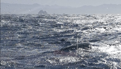
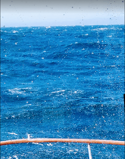
The weather seemed to be building and it was Les’s watch. She called me up and told me that she just wasn’t sure what to do. Unusual for Les. I have to admit it was getting pretty wild. I’ve been in heavy seas before in a sailboat. Twenty to thirty foot swell with 40-50 knot winds half way between San Diego and Hawaii. The usual. The tactics you use in a sailboat are very different than a powerboat. I took the boat off auto pilot because it wasn’t keeping up with the wave train we were bashing into. Bob had done that before when it got pretty rough. I slowed way down and suggested we roust Captain Bob out of his nap, poor man. We were in 15-20 foot short period swell and gusts of wind in the 45, 50 and 60 knot range. He came up and looked around. We’d been following a course about 15 miles offshore. After a brief confab, we collectively thought that it might be a bit less sloppy a bit further in. Les mentioned that she really didn’t want to be out in such large swell in the dark, because then we wouldn’t be able to see what was coming at us. Logical that is… Bob agreed with her and we decided to make for Port Orford about 15 miles away. So, we crabbed towards the coast. The closer to shore we got, the more the conditions moderated, the more crab traps, but I’d rather dodge traps than 20 foot combers any day. We were able to get out of the maelstrom just before sunset and found a nice anchorage just behind “The Heads”.
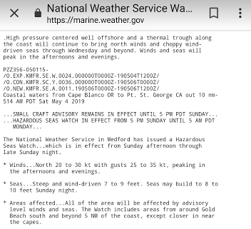
5/3/19. We left Port Orford in the morning. Instant repeat of 5/2/19, smoothish in the early hours, building as the day progressed. The weather report did not look particularly appealing and was calling for short period 8-10 foot swell with 20 to 30 knot winds… and building. We decided to head for Coos Bay Oregon. It was slow progress, but we got to the mouth of the jetty at around 1530. Conditions looked pretty safe to go over “the bar” with 4-6 foot swell and 20 knots of wind, but as we were crossing we were hit by an errant 8 foot breaking wave from the port quarter… we experienced a significant roll and partial broach. This is what it did to the salon furniture:

And… that is the reason that Bob always has everyone on board put on life preservers whenever crossing a bar. Things can go wrong very quickly and if you broach and your boat is sinking from under you, there is no time to collect lifesaving gear. Have it on. Period.
5/4/19. The Oregon coast Weather Report:
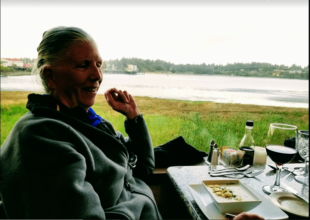
5/4/19. A day off in Charleston, Oregon.
Glad to be standing with my feet firmly planted on a non-moving object. Hmmm.. the Earth is traveling around the sun at roughly 68,000 mph.
Well hold on now, steady as she goes. Our teeny solar system is orbiting around a massive black hole at the center of the Milky Way galaxy at half a million mph.
And… we, along with our galaxy cousins in the Milky Way, which are part of the Virgo Supercluster, is falling into the Great Attractor, a huge group of galaxies called the Laniakea Supercluster, at one and a half million mph. Fabulous name that, Great Attractor…
And all of that is superimposed on top of the natural expansion of the universe, which isn’t really a speed, but is happening at 75 kilometers per second per megaparsec. Thats per MEGAparsec mind you.
Thought you should know…
5/5/19. We left Coos Bay and continued up the coast of Oregon and Washington. For the most part, until we reached our right turn at Tatoosh Island and Duncan rocks our progress was uneventful. Well… there was this little thing that happened when we were about 7 miles off the Columbia bar. As we crossed the flow and were just heading along minding our own business, we ran into a tidal rip. It was the mother of all tide rips. Ten to 15 foot standing waves lined up closely together like haystack henchman blocking our path. Well, really, it looked and felt like that. If you’d been there you would have agreed. Rise up, throttle down, lift over the top, tip onto the backside, throttle up in the trough to keep steering and stabilizers working, rise up, throttle down, lift over the top, tip onto the backside, repeat… After a few minutes it began to ease. We could see a distinct tide line ahead, a sharp demarcation and very visible line between the rip and the seas beyond. What a wild ride just to get there. It didn’t last long, and thanks to the upgraded, oversized stabilizers and gear that Bob put on Zebrina, and his steady hand on the controls, we made it through. He knows his boat very well, and Art DeFever, the designer, knew what he was doing. As we passed over the line, the seas on the other side were nearly flat. In retrospect, we should have been 10-15 miles out. That was Bobs thought, but we got closer in than that. What a mistake. It was a strong ebb that caused the chaotic seas as we crossed the flow. It is a big… big… big river. Respect it. Check the tides at the mouth of the river. If it is an ebb tide stay further off shore. Or just do it Bob’s way and stay further offshore so you don’t have to worry about it.
The other interesting note was what happened when we rounded Cape Flattery / Tatoosh Island / Duncan Rocks at midnight and turned into the Strait of Juan De Fuca. It was intensely dark and the buoy that was supposed to mark Duncan Rocks was not visible on radar. We never did see the red light of the buoy. We trusted our chart plotter and verified our position with the GPS units on two smart phones and a tablet that all had independent navionics systems, and all showed that we were in the right place. It’s always good to have many data points available rather than just one, now, isn’t it… I found out later when researching past “Notice to Mariners” chart updates, and read some fine print on a publication posted a month before, that the steel and lighted buoy had been replaced by a phantom “AIS” electronic buoy only visible on an electronic chart, but not in real life. How nice. The rounding was uneventful, but a bit scary because of that.
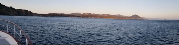
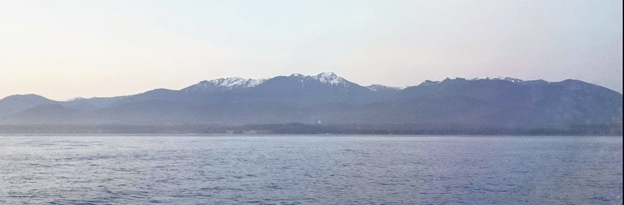
As soon as we turned East we had following seas at around 8 feet at 10 seconds. Surge, roll, yaw, surge, roll, yaw, surge… in complete darkness, but we easily made it through all that until astronomical dawn (google what that is) at around 0445. The further up the Strait we went, the smoother it got. Les and I continued East, and Bob slept below. We’d kept him up way too late. We could start making out the shoreline and other things like tankers, container ships and fishing boats. It’s not like we didn’t know where we were. Our chart plotter let us know that, AIS (Automatic Identification System) let us know where most of the boats were, and radar confirmed the chart objects and boats locations reported and not reported by AIS. As the sun came up, we started seeing mountains and islands and trees on shore and… as we got further into Puget Sound… mountains… Mount Baker, Glacier Peak, The Three Sisters…
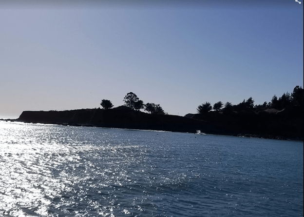
Our first port of call was Port Townsend at Port Hudson Marina, and this is a picture of the first morning there.
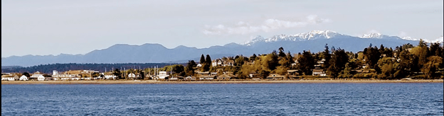
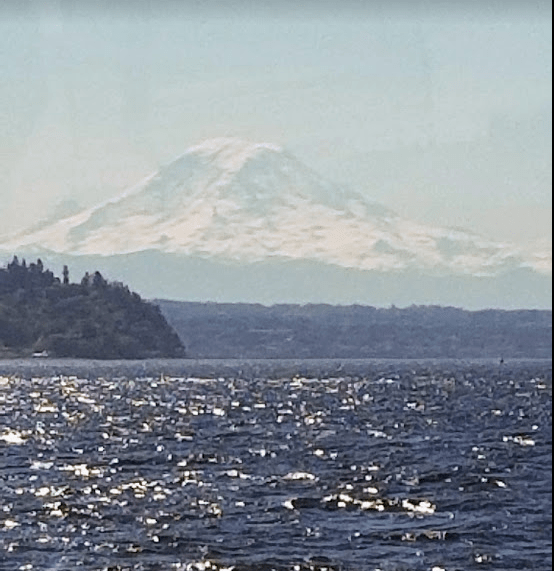
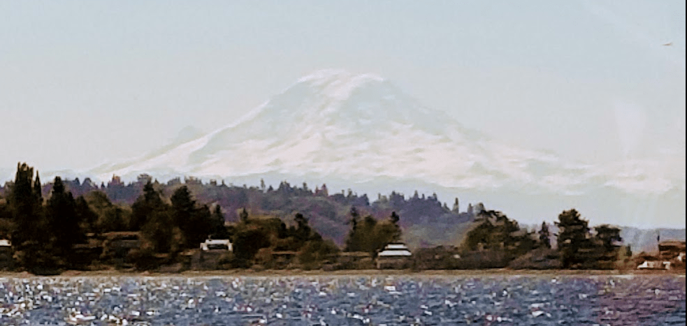
We stayed for a couple of days enjoying the delightful town, and then left for the Des Moines Marina which is the closest marina to Sea-Tac International Airport, our destination after 1189 miles at sea. Of course the further South into Puget Sound we got, Mount Rainier was always visible…
After our experiential voyage up the coast, we left Bob at the Des Moines Marina on Zebrina, and rented a car. We drove back to Salpare Marina on Tomahawk Island with renewed respect for Art DeFever designs. Zebrina and Captain Bob had kept us safe coming up the coast, and we learned so much about how the boat handled and how to manage it through rough passage conditions.
The next phases of our ongoing voyage of exploration are covered in “Our Columbia River Passage”, Part 1, 2, and 3. Our watery path led us down the Colombia River, out over the infamous Colombia River bar, up the rugged coast of Washington, through the Strait of Juan De Fuca, into the Salish Sea and waters further North in our very own boat, Great Northern.

Ah, memories! Looking back over the last 9 months, that trip seems like it happened ages ago!
Les
LikeLike