
After a few days of exploring, we left Cathlamet and started downriver again.
The Columbia west of Cathlamet broadens and changes character. The rolling foothills give away to delta-estuarian topography, lowlands, broad waterways, large and small sand islands, and skinny water. The main channel is constantly dredged to accommodate seagoing ships and large barges. It is deep and easy to navigate, but you need to pay attention to where you are. Wandering too far out of the clearly marked channel will result in a grounding in sand and mud.


Our intention was to enter the Astoria West mooring basin and get a slip for a few days. This aerial picture from the marina’s webpage shows the marina entrance off of the Columbia which flows past it right to left. When we got to the opening and briefly thought about going in, the current was so strong I felt we would not be able to safely make it through the entrance unless we did so at speed. The G dock right inside the entrance left little room for error, so we opted out.
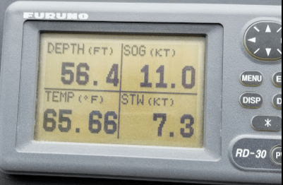
This data screen tells the story. STW, Speed Through Water, is how fast the boat is moving through water. SOG, Speed Over Ground is just that, the speed that we are traveling over the ground. That means the river current is running at 3.7 knots. That’s 4.3 miles per hour… a fast walk.
We put the engines in neutral and glided past the entrance as a test. We were still making around 5 knots. The river was in full ebb and just screaming past the marina.
We could have waited for a couple of hours for the tide to change and the current to lessen, but we decided to move on to Warrenton, a commercial fishing center another 3.5 miles downriver. The chart showed an easier pass out of the main channel into the Skipanon Waterway leading to the commercial docks of Warrenton.

Our bad for not paying as much attention to the tides as we should have. It’s a river after all… Well we now know… it’s a BIG river. The tidal range around Astoria averages between 4 to 9 feet. During the flood tide the river actually changes direction of flow and reverses flow. As you an see on the Navionics chart screen the blue arrows are showing the river flowing backwards with a 1.6 knot current. Simply amazing… eh?
That tidal change is felt all the way up to the Bonneville dam, 125 miles upriver. At St. Helens the downstream flow never reverses, but it does slow. At the rivers mouth a different story emerges, and the tide change has a major impact on river flow and what happens to the water flowing over the bar. The best time to traverse the bar is at the very end of a high flooding tide, just before the slack tide and the ebb begins. The water is deepest then and the incoming ocean waves are quietest and least affected by river flow. The worst time is in the middle of a maximum ebb tide when the water rushing out of the Columbia runs headlong into the incoming ocean waves making them stand up and break over. Surfers will know exactly what I mean…
Recreational navigators attempting to cross the bar should heed the Coast Guards warning… never attempt to cross the bar during an ebb tide. It’s a different story for commercial traffic, but when the ocean swell is large and the ebb flow is at its peak, they heed the warning as well.
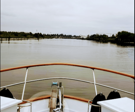
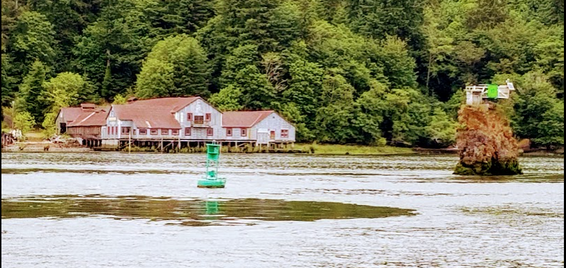
This is the entrance to the Skipanon Waterway which leads to Warrenton. It looks pretty wide, but in reality it isn’t. The channel was dredged in the middle only, leaving a section deep enough for two commercial boats to pass each other with little extra room. The edges were very shallow and ended in mud. We went right down the middle and thankfully didn’t meet anyone on the way to the docks.
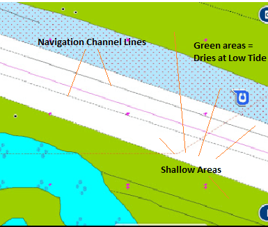
The area between the Navigation Channel Lines on the chart, shows a navigational channel about 60 feet wide. The shallow areas on either side of the navigational channel are just that. Stay out of them. The green areas dry at low tide. The tide range at Warrenton averages between 4 and 9 feet. So at the top of a high tide there is plenty of water in the waterway. At low tide it is a different story. Best to stay in the channel either way.

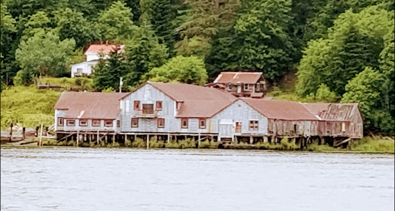
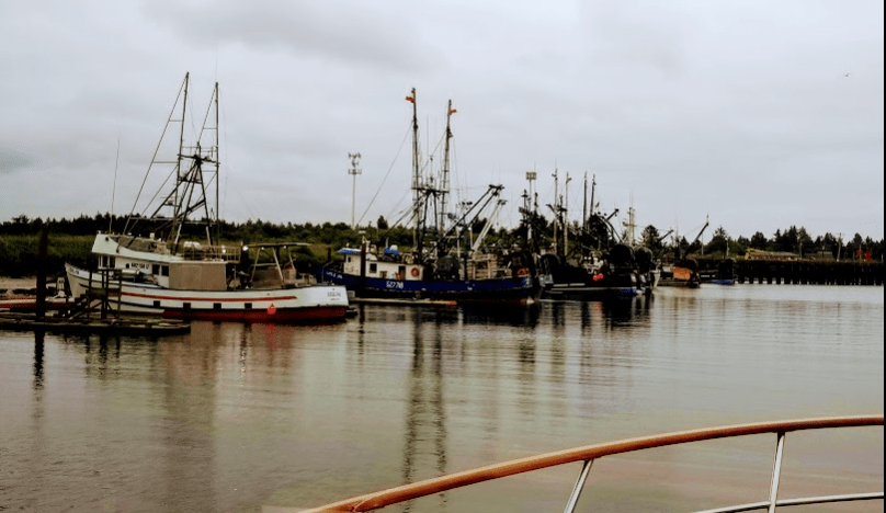
Next up… a large, multipurpose cannery. We talked at length to the marina manager about the area around Warrenton and about the cannery. Apparently it burned to the ground in 2013 due to a roof fire. Everything but the ice house burned. It took a couple of years to permit and rebuild and has been open now for about a year and a half.
The new plant runs 24/7/365 and processes whatever comes in season. They process up to 120,000 pounds of groundfish and 90,000 pounds of Dungeness crab per day. Les and I can attest to the 24/7 operation. From our berth across the Waterway, we saw massive arc lights and heard fork lifts operating all night long, offloading the catch from a steady stream of commercial fishing boats.
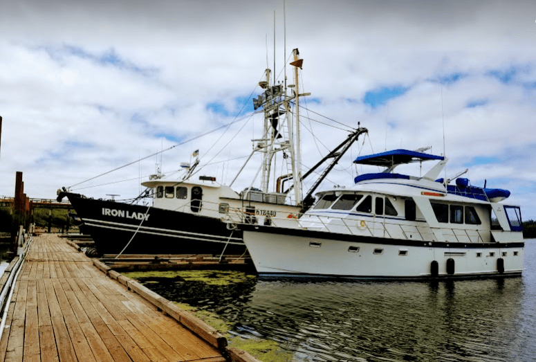
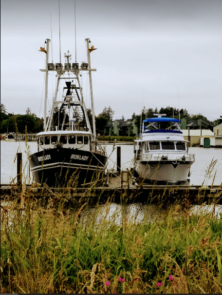
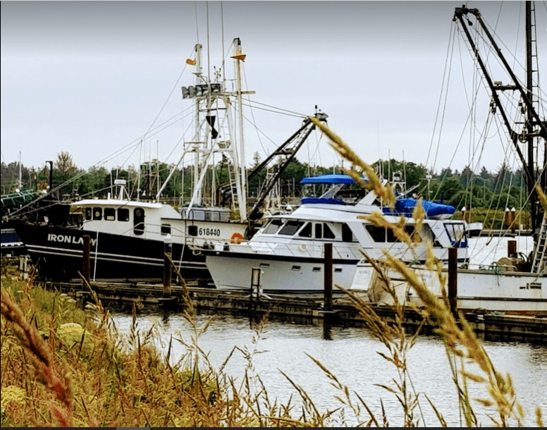
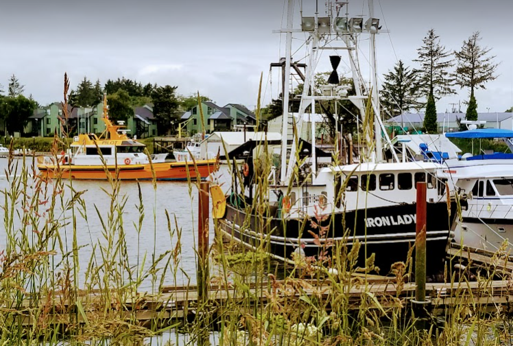
Great Northern meets Iron Lady. Art DeFever the designer of our boat spent his early design years designing workboats and tuna clippers that were designed to stay offshore months at a time. You can see some similarities between the stout fishing vessels and Great Northern. They are meant to go out to sea and fish regardless of the weather. Staying in port means no income.
On another note, it was interesting… we were at the Warrington dock for several days. The pilothouse doors on Iron Lady were open, lights were on. No one was on board or came to the boat all the time we were there. It’s like they got to the dock, tied off the boat, left, and went home. Well, what’s to steal? All the equipment is bolted or welded down, but that is kind of an Oregon thing. They don’t seem to be as concerned about locking everything up as people do in Southern California… Imagine that…
Bigger and bolder and a lot hardier in steel. That being said there are similarities. Les and I comment at times about how many modern recreational boats look somewhat like a Reebok tennis shoe. I’m not being unkind to the modern tennis shoe, really I’m not, but the emphasis of current recreational boats designed for the recreational market seems to be on the esthetics of the above water hull form, and on the interior design. Characteristics that might make them better sea boats seem to have become a secondary concern.
Les and I crewed for Bob Feldman on his DeFever 53 POC, Zebrina, a sister ship to ours, on a trip to relocate his boat from Marina Del Rey to Des Moines, Washington. We experienced mostly good weather but ran into fairly heavy seas and wind during our rounding of Cape Mendocino. The short period seas were running at 15 to 20 feet with winds between 40 and 45 knots with gusts to 60. Some of the grouped swells were enough to open your eyes a bit, but we never felt that we were in weather that the boat could not handle. We slowed and she just motored on through it. I wouldn’t want that as a steady diet, but it is comforting to know that you are in a great sea boat if called upon to do so.
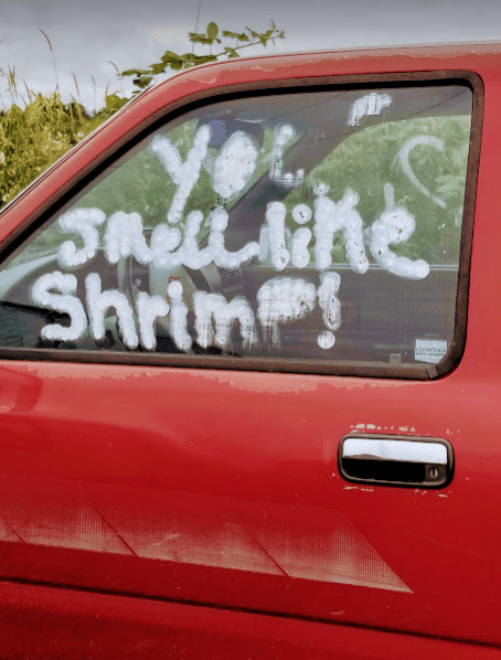
Local vandals. Writing “You smell like shrimp” on the truck window of someone out commercial fishing. Wow… deadly… The window was not broken and whatever was used to write it is already running a bit. Not paint, so someone coming back from the sea smelling like shrimp could hose it off when he or she got home.
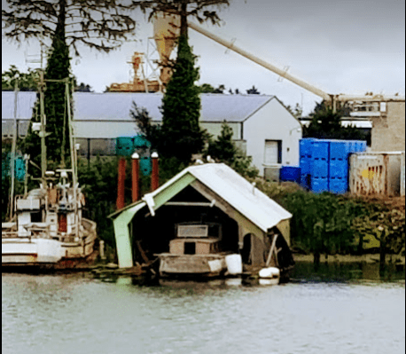
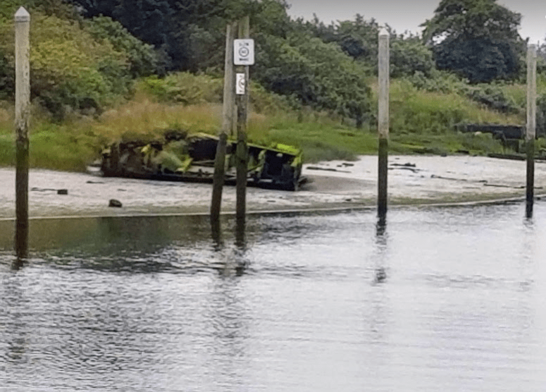
Someone’s dream. A very old wood boat with great lines left to rot in a boathouse in front of the cannery. Is it being restored, or has it been abandoned to rot? Hard telling… but across the Waterway it looks like it is just rotting…
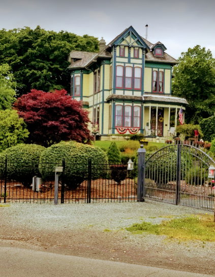
On a walk about town we ran across this old Victorian. Most likely a house built by someone in the lumber trade…

We stayed at the commercial dock in Warrenton for several days waiting for a good weather window. We needed 24 hours to make safe passage up to the Puget Sound.
If you are ever in Warrenton and love Thai food, Nisa’sThai Kitchen is a must visit restaurant. Across the board good to great, clean, friendly, large portions, attentive staff… all at a reasonable price. They have hit the target.
Part 3 of 3 will be posted soon… it covers our passage from Warrenton, out over the Columbia Bar, entering the Strait of Juan de Fuca, an overnight stop at Neah Bay and our final destination for refueling at Port Angeles, Washington.
