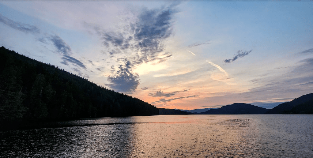
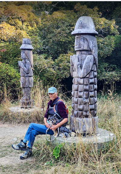
Burgoyne Bay has been alluring, and slyly morphed into the status of distinctive versus being just another comely whereabouts we once visited. One might probe what led to that transformation, eh? A few themes it embodies resonate with our travels throughout the territories under Thither and Yons control: It has reasonable and secure anchoring depths, haven like scenery, challenging trails to hike, ethereal sunsets, no marina, no fuel dock, no water source, and nowhere to buy a t-shirt to prove we were there.
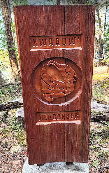
What’s in a name one might ask: Burgoyne Bay, in the local Halkomelem language: Xwaaqw’um. Figure out how to say that one without an AI app. The shores of the sizeable bay on Salt Spring Island are part of the Burgoyne Bay Provincial Park, Mount Maxwell Provincial Park, and Mount Maxwell Ecological Reserve. Those designations translate to: No houses, no summer cabins, no structures to speak of and with the exception of a park personnel habitat building and dock, there are very few non boating related electric lights. And, with the exception of holiday weekends, there seem to be few mid-week visitors to impinge upon the sense of solitude. There are plenty of other places to go on Saltspring Island if you are in need of having those things closer at hand.
It was named by Captain Richards after Hugh Talbot Burgoyne who served on the HMS Ganges, the flagship of the Royal Navy’s Pacific Station at the time. Ganges should ring a bell. Richards named many features during his survey after people or ships of the station… probably because he didn’t speak Halkomelem, couldn’t pronounce the names that the indigenous had used for centuries, and just didn’t concern himself with the concept of using indigenous nomenclature because it was the norm and a distraction to worry about that. He had a flag. He planted it, and named what he felt compelled to name. Wouldn’t you?
Also, just in case you harbor a bit of curiosity about the Islands name : Saltspring or Salt Spring as the islanders prefer. The island is named for brine pools in its interior at the north end. So now you know. If you are curious about what kind of brine is present and if they might harbor brine shrimp… well look it up. I’m sure someone, somewhere got a grant to study it and put out a paper about it. Publish or perish. Above all that, there is always something more to a name than when you first see it, and then learn more about it.
More importantly, and back to the present, the Halkomelem name for Burgoyne Bay (Xwaaqw’um) means “female merganser duck place”, specifically the red-breasted merganser which congregate in the Bay year-round. We didn’t see one while we stayed in the Bay, but… they were probably performing their congregational tasks over at Ganges for the week attending the Ganges Fair.
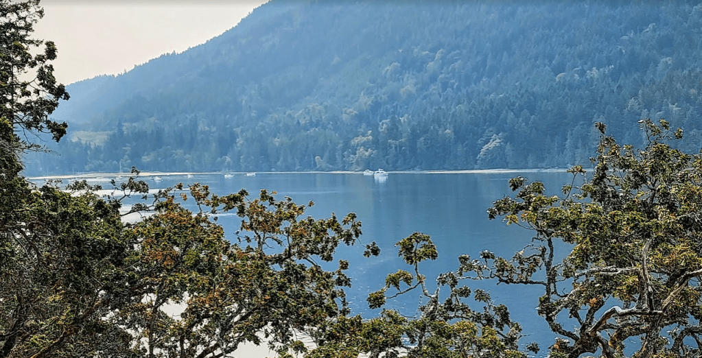


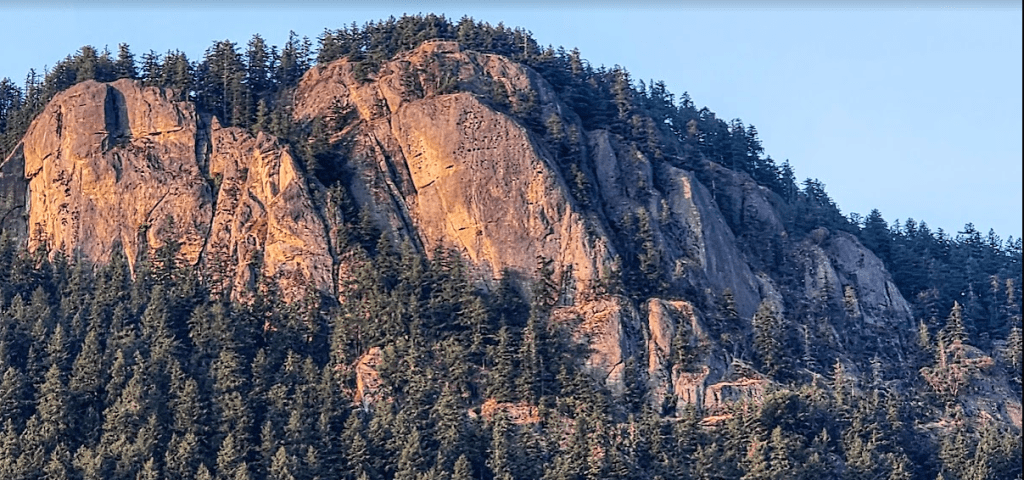
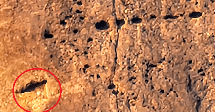
However: Gaze carefully upon the large cave on the bottom left of the following picture taken with telephoto:
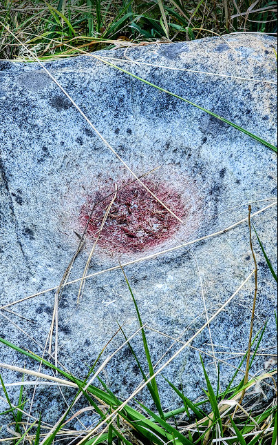
Before I venture another step, be it 2 feet, 24 inches, 50 centimeters or just about half a meter: There is something important to discuss: The Pacific Banana Slug, Ariolimax columbianus
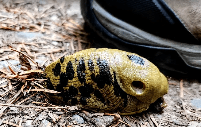
This little niffer was just a few centimeters from becoming slug jam or what is commonly known as: Waffle stomped skishy, sticky, slimy mush.
Not to belittle a point, but Ariolimax columbianus can grow up to 25 centimeters long, making it the second largest terrestrial slug in the world. Oh… for you mere Earthlings… 25 centimeters is akin to what a few sapians in the world still refer to as: 9.84252 inches, or to be more specific, it is 0.82021 feet. That’s a big slug by any measure. But I so prefer the metric system, eh? Shouldn’t you?
Onward:
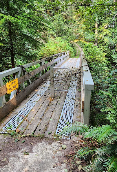
We didn’t. We were on trail 21 or 23 or… well the park maps were misleading at best. But! We’d just traipsed up a very steep trail straddling up an unforgiving, contemptuous, ill mannered hill. And it didn’t take a whole lot for us to determine that to go forward might elicit peril. Or, if we turned around and hiked, stumbled, and skiffed back to GN… that we would be rewarded with sustenance and more.
On the Way back:
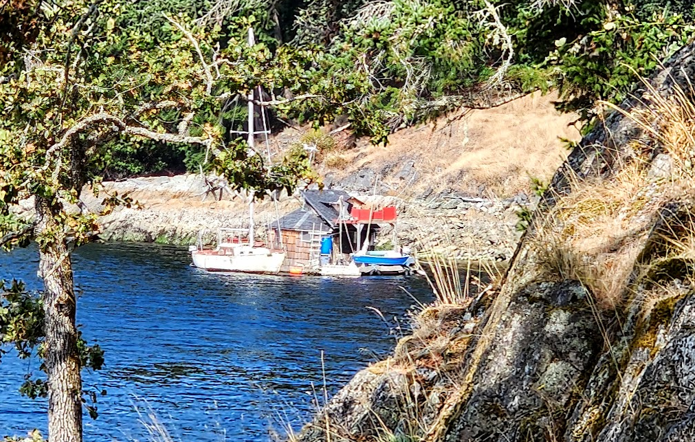
Amongst the salal, Oregon grape, swordfern, ocean spray, douglas fir, western red cedar, spruce and hemlock we ran across an old out building of the farm that once tilled the soils, raised alfalfa and grains for the cattle, milked the cattle and sold the milk to the villagers near at hand.
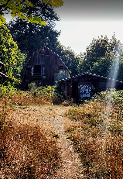
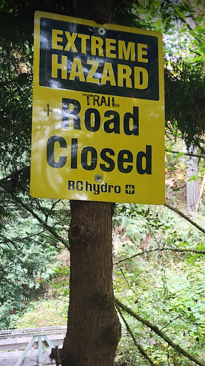
Next up, as we got nearer the building that formerly housed milking apparati:
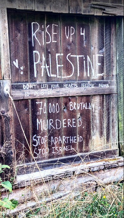
Now. To start with… this is Canada. It may be where you live, and it may not be. And… I make it a point of attempting to keep my political and religious views… out of this blog. With that statement, my first observations: There are no misspellings. The three points stated are clear, concise, and most likely heartfelt considering how clearly they were written. In the “margin” painted on a wood slat that holds the door together is the statement: “Don’t let your hearts become numb to injustice”. I didn’t focus on that until I’d read the larger printing.
Just think about that last sentence for a moment, or the whole “sign” for that matter. And… wonder about who wrote it. I don’t feel it was written by… an “adult” per se, but a guy, not a gal, of late teen or early twenties was the author. It is not the kind of location to support otherwise. This is a place where younger sorts hang. The hiking is challenging. The upland rock is inspiring. Testosterone and estrogen levels are dancing a jig.
I see an algorithm at play: CTV News, Canadian CBC, Global News and City News message the Canadian “Mood” about Gaza. Parents see it, their kids see it, sibs see it and for the most part parrot and propagate their interpretation of what they saw, heard, and felt. Why not share?
As we enter the dilapidated old milk building, an apparition and bit more of the story unfolds:
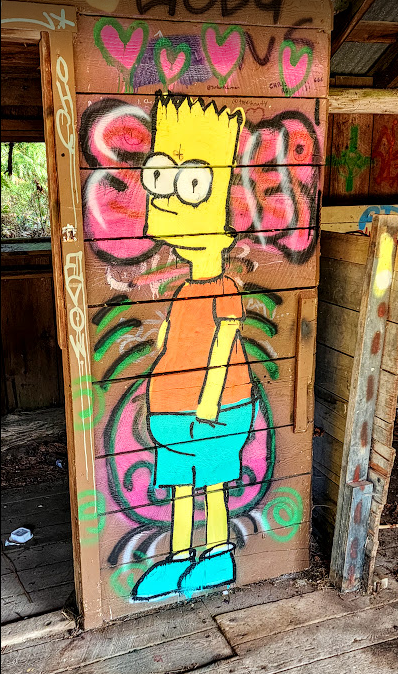
Whatever and wherever the rest of that story leads, it is a story for another day.

When I was small, way impressionable, far more mold-able than now, our family did a lot of camping. We camped all over Washington an in many other places in the western U.S. It was a thing. Most Washington State parks had a small “amphitheater” like this one:
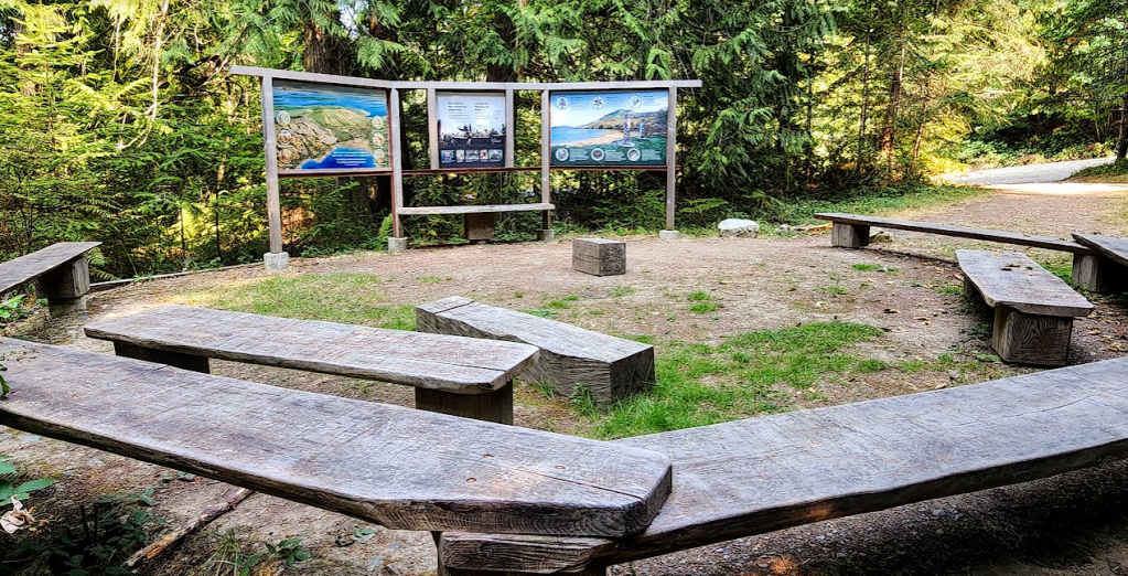
It was there that one of the Rangers would build a fire and then talk to whoever was present… one person or 20 or more. Didn’t matter. Topics: history, ecology, preservation, forestry and the educated answers to whatever questions were asked. That is what I felt. That is what I saw… when I rounded the corner at the beginning of one of the trails and saw the “amphitheater” of my yout. I can only hope that as you read this, it sparks a memory of one of your “amphitheaters” and what you remember about it. And if you can’t remember about one or didn’t have one… go out and find one.