Geologic Time. An interesting concept studied by many but understood by few. Where you stand, hike, swim, ply your craft, or gaze upon… wasn’t always the way it appears now. Continents shift. tectonic plates crash into one another, Islands are lifted out of the sea, to submerge, rise again, erode and contort according to the geologic pressures that mold them. Massive ice sheets scrape their backs, melt and leave their amalgamated debris carried from far away. In comparison, the appearance and advancement of Sapiens across the landscape is nothing more than a mere blink of an eye when mapped against geologic time. Not even that. It is a muscular trembling and twitching of the eyelid before it has the temerity to blink away the mote that is causing an eye to water…
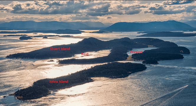
Stuart Islands current resting place places it as the most Westerly Island within the San Juan Archipelago. Geologically, It is composed of closely folded sedimentary rocks, mostly sandstone and siltstone that are the remnants of an ancient river delta modified by uplifting caused by tectonic plate incursion, earthquakes, vulcanism, landslides, ocean currents, rain and wind. Geology at work here people! Currently, the island sports two ridges of harder rock that lie in an easterly to westerly direction. In-between them, softer sandstone and siltstone are found. During the last period of ice age glaciation, of which there have been many, the encroaching mile high ice sheet gouged out the softer stone which was eventually flooded by the sea. The result for this epoch: two fine harbors: Reid and Prevost. Both are on our personal list of favorite anchorages. They are well protected from all but the most robust wind events and the holding in mud and sand is excellent. Let the wind blow, lay out a bit more chain and crack open a beer. That’s the spirit!
Stuart Island was named by Charles Wilkes during the Wilkes Expedition of 1838–42, Authorized by the US Congress, the expedition, explored and mapped the Pacific, Antarctica, the northwest coast of the United States and the Islands within Puget Sound. The Sound was named after Peter Puget, a lieutenant who accompanied George Vancouver on the Vancouver Expedition in 1792. Stuart Island a, diminutive spec of land within the San Juan Island archipelago was named to honor Frederick D. Stuart, the captain’s clerk of the expedition.
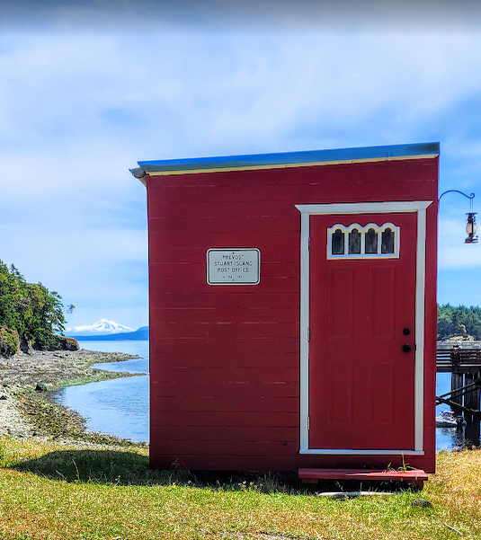
Prevost Harbor is named after James Charles Prevost, an admiral in the British Navy and captain of the ship he commanded, the HMS Satellite. Satellite Island that borders the Northern edge of Prevost Harbor is named after his ship. Prevost was serving as a commissioner to help settle a border dispute between the US and Britain. Heady time folks… heady times. Buried amongst the time of the negotiations, an interesting event occurred: the Pig Wars. I thought I’d share the story: https://en.wikipedia.org/wiki/Pig_War_(1859)
Of course all the naming of territories, islands, the coastal and inter-coastal waters was a rather silly and pretentious endeavor. They already had names associated with the indigenous Salish peoples that included members of the Lummi Nation, Samish Indian Nation, Swinomish Indian Tribal Community, and the Suquamish Tribe. Of those groups 20 languages were spoken and none of the Brits or Americans could speak them or pronounce the indigenous names. So… they made up new ones. Conquer. Claim. Subvert. Rename. That was the norm at the time and still is, eh? Nuf a dat for now.
On May 22nd 2025, just before the Memorial Day weekend, Les, Leo, and I left Ludlow intent on upgrading our adventures within the Salish sea. We made the passage across Juan De Fuca, entered the San Juans through Cattlemans Pass, traversed San Juan Channel, and sashayed past Spieden Island, Ripple Island and Johns Island. Reaching Stuart Island at last, we anchored in Prevost Harbor. We’ve spent time in both Reid and Prevost, but we do prefer Prevost. It has a more intimate and secluded feeling than Reid. The density of anchored boats is usually less. On that day there were 8 boats in the harbor. On Friday and Saturday there were 13 boats. On Memorial Day it dwindled to 7, a perfect density… The day after, Tuesday, there were 4. Oh… it’s so nice to be retired and not having to return to work the day after a national holiday has slipped through your fingers…
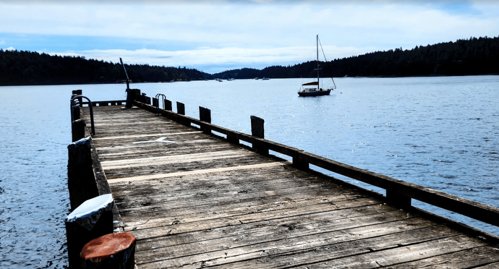
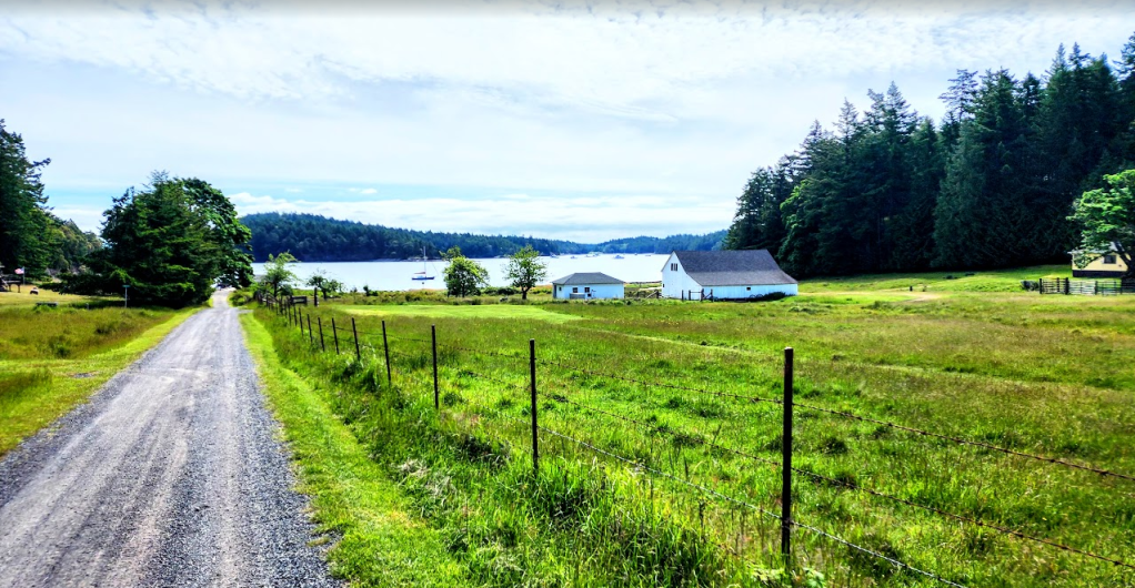
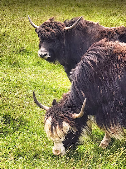
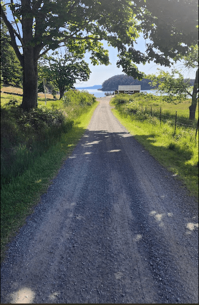
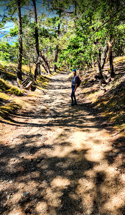
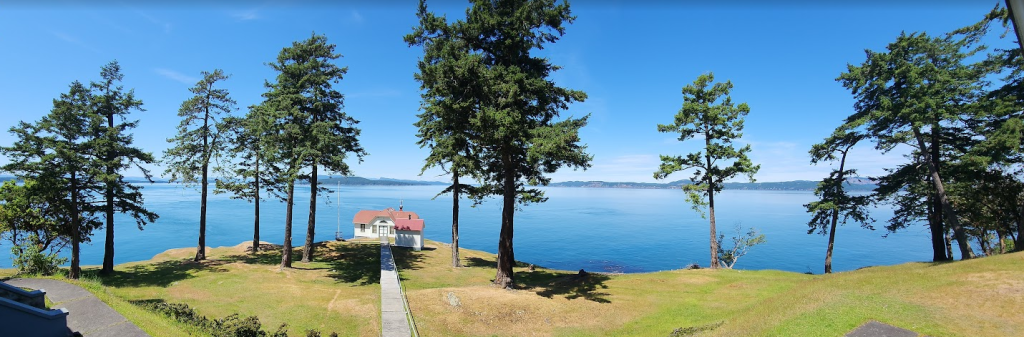
Prevost with its forested shoreline projects a sense of protective serenity. At the West end there is a small community pier with a dock that affords berthing for a few local boats and space for dinghies to tie up. We’ve always found space to tie up our dinghy there. A graveled county road leads from the pier, to the Western end of the island and the lighthouse at Turn Point. It is an easy hike that meanders past the Eriksen farm with its contingent of American Yaks.

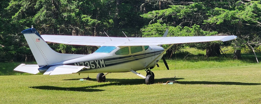
Continuing up the road leads to the small “airport” with a grass runway. One of two on the island.

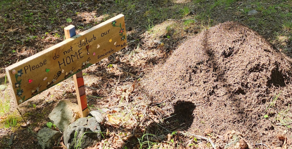
The road continues past the high rise condo that houses a vibrant community of ants…
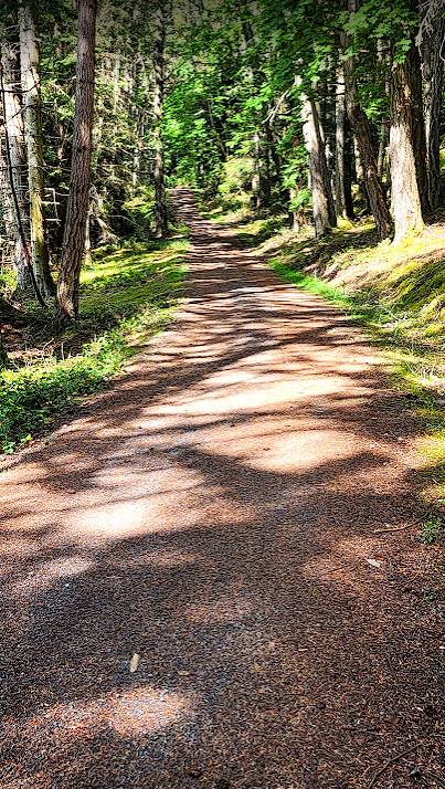
Starting at the pier, the hike out to the lighthouse and back ends up being about 4 miles. Hiking from the Reid Harbor park dock makes it a 6+ mile jaunt and that is important distinction just now. A 6+ miler is a bit too far for me and the 4 mile distance fits right into my recovery program… I had open heart surgery 6 weeks ago to repair a leaky atrial valve and a dilated aortic root, more commonly known as an aneurysm. I now have a nice new bovine bio-prosthetic atrial valve and a Dacron sheath that replaced the dilated aortic root. We’ve named the valve Bessie. We’ve not named the Dacron sheath that replaced the aneurysm, but we are working on that. All suggestions will be considered. So name the sheath and let me know. Might as well, eh? Anyway, enough of that… but it does explain why my blog has been silent. That will most likely change as I do love writing and sharing what we discover while plying the waters of the Salish Seas.
As I write this, a gaggle of Canadian geese is paddling serenely past Great Northern. The gaggle consists of several adults in the lead, various adolescent goslings in the middle and other adults taking up positions following and to the sides of the children and teenage contingent. It is an elegantly organized and protective troupe. It has to be. There are eagles and other predators lurking about. Considering that only 21% or so of goslings make it to 8 weeks, maintaining a protective escort is a constant defense mechanism in their world. This evening the geese will probably find a bushy place to tuck into along the shore of the harbor. That affords some protection against foul play during the night. For now they just cruise around softly honking to each other and feeding on the tasty tidbits that they find.
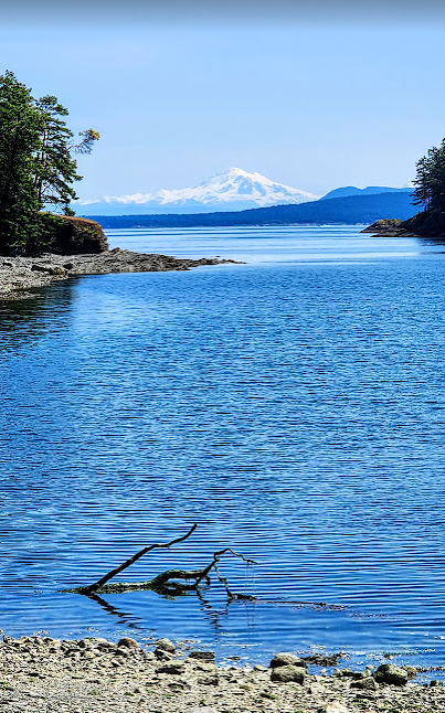
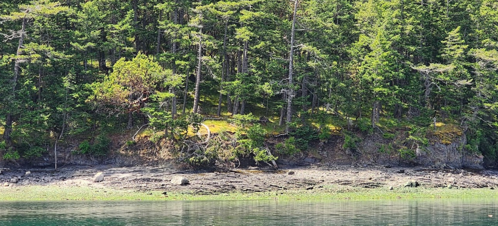
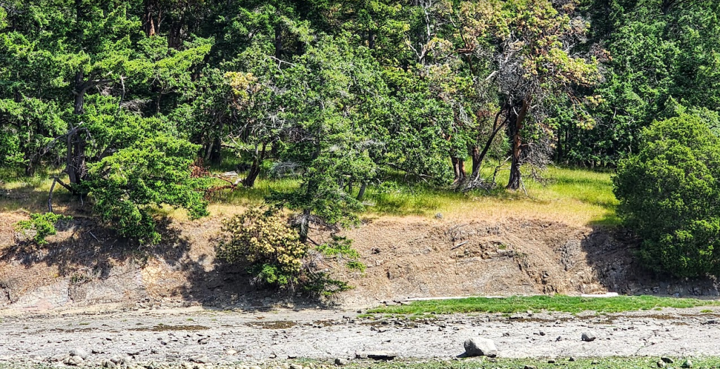
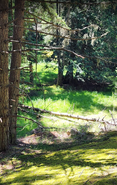
Across the harbor to the South lies a ridge of harder rock that separates Prevost from Reid Harbor. The shoreline is sandstone and It is wooded with Douglas fir, Sitka spruce, big leaf maple, western red cedar and madrona. Occasionally you see other native trees such as western hemlock, grand fir, Pacific yew, and Dogwood. The forest is not as thick as what you see on the mainland because there is far less top soil in the islands in general. Meadows and other grassy areas are common. Bird life abounds.

Nice pics and looks like a great hike.
LikeLike
Beautiful photos! You are doing so well!! It’s hard to believe you can walk 4 miles 6 weeks after your surgery. You must have been in really great shape before the surgery to accomplish healing so quickly! Good for your. Sending love and hugs ❤️🤗
Yahoo Mail: Search, Organize, Conquer
LikeLike
5.6 miles today… and it was not a cakewalk trail! Yes, people I was in great shape. Heart, lungs legs were fine. Aneurysm not so good. Fixed that. New valve. Recovering Twas quite the complicated surgery But now… I move on. No other choice… … Blair
boatingongreatnorthern.org
LikeLike
How the heck does it show my response is from my husband not me? Strange things going on up North! Lol
Yahoo Mail: Search, Organize, Conquer
LikeLike
I do not know…
… Blair
boatingongreatnorthern.org
On Mon, Jun 2, 2025 at 1:30 PM Salish Sea Cruising With Blair, Les, and Leo
LikeLike
I’m not sure. I have you in on your own email. I also have his… and for some reason you are responding to his. Do you get mailed a new post to your email. That is what should happen… Not sure what I can fix unless I remove your email and send a new request… Lemme know.
LikeLike